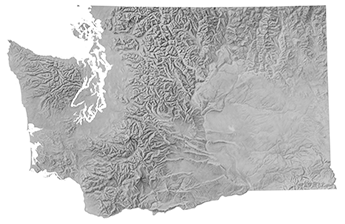
Washington State (USGS)
Artist
UnknownCreation Date
Unknown. Pre-1980 Mount St. Helens eruption.Scale and Size
Original art scale: 1:1,500,000Original art size: Unknown
Cropped digital art size: 64.22 × 42.13 cm at 300 DPI,
7,585 × 4,976 pixels
Terms of Use
No use restrictions. The shaded relief is in the public domain.Georeferencing
Albers Equal-Area Conic ProjectionCentral Meridian: 120.1W
1st Standard Parallel: 23.5N
2nd Standard Parallel: 45.5N
Origin Latitude: 23N
NAD83 Datum
Map Compatibility
Relief modified May 18, 2020, by Tom Patterson to fit 1:1 million USGS National Atlas drainages in the projection noted above by warping it in Photoshop. The post-eruption Mount St. Helens summit renderedfrom digital data was also added.

