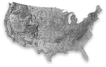
United States–Harrison
Artist
Richard Edes Harrison, USACreation Date
1969. Relief published in The National Atlas of the United States of America, 1970, by the USGS.Scale and Size
Original art scale and size: Not knownPublished map scale: 1:7,500,000
Cropped digital art size: 62.85 × 40.28 cm at 300 DPI,
7,423 × 4,758 pixels
Terms of Use
No use restrictions. The shaded relief is in the public domain. Space permitting on your map, please cite Richard Edes Harrison as the source.Georeferencing
Albers Equal-Area Conic ProjectionStandard Parallel 29.5N and 45.5N
Central meridian: 96W
Latitude of projection origin: 23N
NAD83 Datum
Map Compatibility
Relief art modified by Tom Patterson to register with 1:10 million Natural Earth vectors: www.naturalearthdata.comThe relief download includes a Natural Earth coast shape file with embedded projection information.

